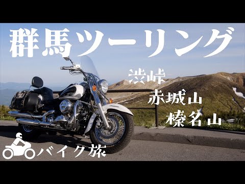
群馬ツーリング【DSC400】Japan Travel Vlog GUNMA Touring

Due to changes in my living environment, I could not ride a motorcycle for a long time. First time touring in 8 months! Today's destination is ... Gunma Prefecture travel route From Yokohama, head north along the Kan-etsu Expressway. Mt. Akagi and Mt. Haruna, and then to Shibu Pass, the highest point on the Japanese National Highway System.
To get to the Kan-etsu Expressway from Yokohama, have to get off the expressway once and go through a lower road in Tokyo. It is a bit troublesome. Going northward in Tokyo. Yokohama to ...
Nerima About 1.5 hours after departure. the entrance to the Kan-etsu Expressway. Heading north on the Kan-Etsu Expressway Traffic jam Rear-end collision in the merging lane. I must be careful !! Nerima to ...
Akagi drive on the Kan-Etsu Expressway about 110 km. get off the highway here. From here will take the normal road to Mt.Akagi Running through woods and fields. It has a tranquil air peculiar to the countryside.
Akagi IC to ... Akagi shrine Mt.Akagi is a very popular hill-climb course for cyclists. A long slope leads to the summit.
the maximum incline 9.7% It must be a great feeling of accomplishment to climb up this slope. The summit of the mountain is now in sight. I found a restaurant that serves juwari soba (buckwheat noodles). I will drop by there later. finally reached first destination.
"What's out there?" Lake in front of the shrine. "O-numa"'(The Great Swamp.) A caldera lake stretches in front of Akagi Shrine. It is connected to the Tone River to the west from Mt.Akagi There is a legend that Princess Akagi was reincarnated as Akagi Daimyojin by the power of a dragon in the O-numa.
"Akagi shrine" The main shrine of Akagi Shrine, of which there are about 300 throughout Japan. The deities are Akagi-daimyojin, Okuninushi, and others. The deity is believed to be blessed with the promise of fulfilling women's wishes. Amulet of marriage Beautiful embroidery. "Ema (votive picture)" There was a motorcycle ema.
Ema are wooden plaques that people write their prayers or wishes on. "Drive safely" I wish have nice & safe trip . go to soba noodle shop I saw on the way here. Stone ground. Jyuwari Soba.(100% buckwheat noodles)
Kaze no Iori (Wind hermitage) "Today's Tenpura" Do the ingredients change from day to day? Wild vegetables Tenpura & soba noodles. eating Yummy Sprinkle with rock salt and eat. I love it . It is past noon.
must hurry and get off the mountain. Mt.Akagi to ... Mt.Haruna Shibukawa, Ikaho, and the mountain pass road leading up to Mt.Haruna
The road has many curves and slopes, but like Mt. Akagi, the fresh greenery is beautiful and the road is fun to drive. drive about 1 hour Lake Haruna comes into view on the right. take a short detour.
"Lake Haruna" Caldera Lake stretches across the summit of Mt.Haruna. The lake has a circumference of 4.8 km and is 12 m to 15 m deep at its deepest point. The large mountain in the center is Mt.Haruna-Fuji (1391m) Haruna Shrine is just around the corner. Otorii (Grand Gate).
Signboard of Shukubo (Signboard of Pilgrim's lodging in a temple.) The deity of Haruna Shrine is the god of farmers. The shrine was called Haruna-kou, and many ascetic practitioners worshipped there. During its heyday in the Edo period (1603-1867), there were about 100 shukubo (lodging houses) in the area. Seven Gods of Fortune "deck brush burial Mound" Unusual burial mound A rock face that breaks through approach to the shrine. Misuzu Waterfall see a beautiful rainbow to the hall of worship Oh, no... Under construction The sun is setting.
must hurry or the sun will set. Mt.Haruna to ... Shibu pass Drived about an hour and a half .
The elevation increases from here, so we will wear thicker clothes. I putted on thick clothes. Shiga Kusatsu Road From here climb up to Shibu Pass. Located on the border between Gunma and Nagano prefectures, Shibu Pass is the highest point on a national highway in Japan.
The highest point is 2172 meters above sea level The temperature drops with each step. "smell the sulfur!" pungent smell Because of the gas emissions, no cars are allowed to stop in this area. The bare rock face looms before me.
My hands are so cold ! The strong winds nearly blowing me & bike ...!! Gusts of wind Even though it is the end of May, there is quite a bit of remaining snow. If you come in early May, you can see the snow corridor. Elevation 2119m Air quality is 75% of that below "snow" Cold !! Almost to the summit. "The highest point of the Japanese National Highway" The only thing at the top was this stone monument and...
only this view. This is the end of this trip. Results Mileage 533 km , Driving time 16 hours , Refueling 19.63 L , Fuel consumption 25.152 km/L Thank you for watching.
2022-06-21 17:03


